
Polar Vortex Split: Early Disruption Could Bring US Cold in Late November
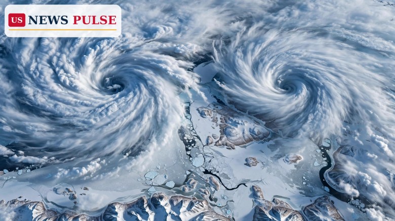
The polar vortex split now taking shape above the Arctic could become one of the earliest major disruptions of its kind on record, forecasters said on Tuesday, November 3, 2026, raising the possibility of colder weather reaching the United States in late November or December — though experts cautioned that a cold outbreak is far from guaranteed.
Meteorologists are already watching the vortex stretch and divide into two smaller lobes. If that develops into a full sudden stratospheric warming, the powerful winds circling the North Pole would reverse. Such reversals usually occur in January, February or March, so a confirmed event between November 6 and 10 would be the earliest since reliable records began in 1958, and only the third November event ever recorded.
Key Points
- Forecasters say the polar vortex is stretching and splitting into two smaller lobes in early November, an extraordinarily early disruption.
- Polar stratospheric winds could reverse from westerly to easterly between November 6 and 10, in a sudden stratospheric warming event.
- If confirmed, it would be the earliest such event since 1958 and only the third ever recorded in November.
- United States impacts would typically take at least two weeks to reach the surface, putting the earliest window in late November and a more likely window in December or January.
- Experts say the most certain near-term effect is milder weather for eastern North America through much of November, not immediate cold.
What Happened
USA TODAY reported on November 3 that forecast confidence has risen sharply that the polar vortex will undergo a major disruption in early November. The report cited Laura Ciasto, a meteorologist with NOAA's National Weather Service, who described the vortex as already becoming stretched out and splitting into two smaller vortex lobes. A split vortex behaves very differently from the strong, tightly wound circulation that normally keeps the coldest Arctic air bottled up near the pole.
The disruption at the centre of the forecast is a sudden stratospheric warming. In such an event, temperatures high in the stratosphere rise rapidly, and the westerly winds circling the pole can weaken, stall and then reverse. A reversal is the formal marker that separates a genuine sudden stratospheric warming from an ordinary weakening, and it is the signal that can, weeks later, reshape weather patterns much closer to the ground.
Background/Context
The polar vortex is not a single storm. It is a large, persistent circulation of cold air and low pressure that forms over the Arctic each winter, held in place by strong stratospheric winds roughly 10 to 30 miles above the surface. When the vortex is strong and roughly circular, frigid air stays locked over the pole. When it weakens, stretches or splits, that cold air can spill southward, producing prolonged cold snaps.
Polar Vortex Split: What the November 6-10 Wind Reversal Would Mean
If the stratospheric winds do reverse between November 6 and 10, the first question will be how strong and lasting the reversal proves to be. A strong, sustained reversal is more likely to push its influence downward. A weak or short-lived reversal may fade before it meaningfully changes surface weather. One artificial-intelligence model ensemble cited in the November 3 reporting pointed to exactly that risk, indicating the event could be weak and short-lived, with little impact on the United States.
The second question is timing and geography. Impacts usually take at least two weeks to reach the surface, putting the earliest plausible window for significant United States cold in late November, with December or January more likely. When a disrupted vortex does deliver cold, it rarely chills the entire country evenly: eastern North America is often most exposed, while the West can remain mild under a different part of the same pattern.
Reactions/Quotes
Laura Ciasto, a meteorologist with NOAA's National Weather Service, described the developing pattern in plain terms, saying meteorologists are already seeing the vortex "become stretched out and splitting into two smaller vortex lobes." The observation matters because a split, rather than a simple displacement, is the structure most associated with a major sudden stratospheric warming.
Polar vortex expert Judah Cohen of MIT offered a cooler assessment of the immediate outlook. He said the most certain impact is a period of milder weather for eastern North America for much of November. That may surprise readers who associate a vortex disruption with instant cold, but it reflects how these events unfold: the initial phase can favour mild conditions before any cold air is displaced southward weeks later.
Why It Matters
The stakes are practical as well as scientific. A major cold outbreak in late November or December would arrive at the start of the heating season, when households, energy suppliers, transport networks and emergency services are already preparing for winter. Early awareness of a possible disruption gives those systems time to check supplies and contingency plans, even if the eventual outcome is mild.
The event also matters for how Americans understand winter forecasts. The polar vortex has become a familiar phrase, but it is often used loosely to mean any cold snap. A genuine split in early November is a rarer, more specific phenomenon, and tracking it correctly helps separate a real atmospheric signal from seasonal hype. Readers can follow other recent weather developments in our coverage of Southwest flooding that turned deadly in Flagstaff and record river crests across the Southwest.
What Happens Next
Forecasters will first watch the November 6 to 10 window for the wind reversal itself. Confirmation would make this the earliest sudden stratospheric warming since 1958 and only the third November event on record.
After that, attention will turn to the two-week lag. Through late November, meteorologists will monitor whether the stratospheric signal propagates downward and how the jet stream responds. For the public, the sensible response for now is watchfulness rather than alarm: no specific freeze, snowstorm or cold outbreak has been forecast for any United States city as a result of this event.
Frequently Asked Questions
What is the polar vortex? A large circulation of cold air and low pressure over the Arctic in winter. When strong, cold air stays near the pole; when it weakens or splits, cold air can spill southward.
What is a sudden stratospheric warming? A rapid warming high in the stratosphere that can weaken and reverse the winds circling the pole, potentially reshaping weather patterns weeks later at the surface.
Why is this event extraordinarily early? Such events usually occur in January to March. A confirmed event in early November would be the earliest since reliable records began in 1958 and only the third November event recorded.
Will the United States definitely get very cold? No. Forecasters say the surface impact is much less certain than the stratospheric disruption, and one model ensemble suggests the event could be weak and short-lived.
When would any cold arrive? Impacts usually take at least two weeks to reach the surface, so the earliest window is late November, with December or January more likely. The most certain near-term effect is milder weather for eastern North America through much of November.
© 2026 US News Pulse. All rights reserved.
 Print
 Save