Las Vegas flash flooding is the warning facing southern Nevada on Sunday, November 1, 2026, as the National Weather Service (NWS) says persistent rain and returning afternoon thunderstorms could turn low-water crossings, poor-drainage streets and desert washes dangerous. Light-to-moderate rain that fell overnight already caused nuisance flooding in parts of Clark County, Nevada, and Mohave County, Arizona, and forecasters kept a broader flash flood watch in place through Sunday night for parts of southern Nevada, northwestern Arizona and southeastern California.
The warning is not for a single downpour over the Las Vegas Strip. It covers a wide desert region where rain that looks modest on a city street can gather quickly in washes and low crossings. The NWS Las Vegas office said the highest rainfall accumulations were expected across Clark, Lincoln and Mohave counties, with shower and thunderstorm chances returning in the afternoon before conditions dry out overnight into the start of the week.
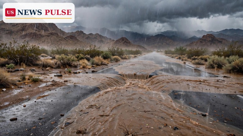
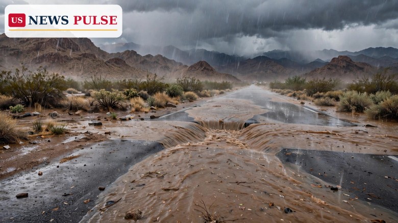
Overnight light-to-moderate rainfall persisted across the region, and the NWS Las Vegas office issued morning flood advisories for two areas where water was already causing problems. In northeastern Clark County, the advisory ran until 9 a.m. PST on Sunday. The office said persistent light-to-moderate rain overnight had resulted in nuisance flooding across northeastern Clark County along low-water crossings, particularly near Valley of Fire Drive, and urged caution in the morning.
In southern Mohave County, across the state line in Arizona, a similar advisory ran until 10 a.m. PST, or 11 a.m. MST. The office again pointed to persistent light-to-moderate rain overnight and nuisance flooding along low-water crossings, and told drivers to use caution on the roads in the morning.
The wider flash flood watch, issued for early Sunday and kept in effect through late Sunday night, covered a much larger area. In Nevada it included Lincoln County, northeastern Clark County, the Lake Mead area on the Nevada side and the Lake Mohave area. In Arizona it included Lake Havasu, Fort Mohave, Kingman and the Hualapai Mountains. San Bernardino County in California was also included.
Forecasters said rain would continue through Sunday afternoon, with conditions varying by neighbourhood. Most rainfall was expected to remain light to moderate, but locally heavier downpours could increase the risk of flooding on roads, in low-lying areas and near waterways. The NWS said excessive runoff could cause rivers, creeks and streams to overflow, and that flooding was also possible in urban areas, locations with poor drainage and low-water crossings.
Flash flooding in the Mojave Desert often looks different from flooding in wetter parts of the United States. Much of the ground is hard and dry, so rain runs off quickly instead of soaking in. Washes that are dry for most of the year can fill fast, and a road that looks passable can hide fast-moving water. That is why weather offices in the Southwest issue advisories for nuisance flooding at low-water crossings even when total rainfall amounts sound small.
Sunday's pattern fit that picture. The NWS did not describe a single severe thunderstorm parked over Las Vegas. It described persistent, mostly light-to-moderate rain through the morning, with the highest accumulations across Clark, Lincoln and Mohave counties, followed by a return of shower and thunderstorm chances in the afternoon. In desert terrain, that combination — steady rain saturating low areas, then heavier bursts — is enough to raise the flash flood risk even before any single gauge records an extreme total.
The rainfall forecast underlined the uneven picture. Las Vegas was forecast to receive between 0.25 and 0.50 inches of rain, while some surrounding areas could record higher totals. Parts of Mohave County, particularly higher elevations, could receive more than two inches. Lincoln County and other parts of Mohave County could see between 0.75 and 1.50 inches. Moderate-to-heavy rainfall in affected areas could bring between half an inch and one inch of rain, according to the NWS forecast reported on Sunday.
The Southwest has already seen repeated flood emergencies in recent days, with evacuations in other desert and mountain communities as rivers and creeks surged. Those events are a reminder that desert flood danger is often local: one wash or crossing can flood while a nearby neighbourhood stays dry, which makes broad watches and specific advisories both important.
A flood advisory, a flood watch and a flash flood warning are not the same thing, and Sunday's Las Vegas-area alerts showed how they work together. An advisory, like the morning advisories for northeastern Clark County and southern Mohave County, means flooding is occurring or imminent in a limited area and is expected to cause inconvenience rather than widespread danger — in this case, nuisance flooding at low-water crossings.
A watch, like the broader watch in effect through Sunday night, means conditions are favourable for flash flooding over a larger area, even if no single location has flooded yet. It is a signal to stay alert, avoid washes and low crossings, and be ready to change plans if rain intensifies. A warning, the most urgent level, would mean flash flooding is happening or about to happen in a specific place.
For drivers, the practical message on Sunday was simple: do not drive through flooded roads or low-water crossings, even if the water looks shallow. Forecasters repeated the caution for the morning advisories, and the same advice applies through the afternoon thunderstorm chances. Water depth and current are hard to judge from a car, and desert washes can rise quickly after a heavier burst upstream.
For residents near washes, creeks and low-lying roads, the advice was to monitor local conditions through the afternoon and evening, when shower and thunderstorm chances returned. Rainfall was expected to decrease gradually by late afternoon and early evening, with conditions drying out overnight into the start of the week.
The National Weather Service office in Las Vegas set out the morning picture in its advisory messages. It said: "Light-to-moderate rainfall will continue through the morning, with highest rainfall accumulations across Clark, Lincoln, & Mohave counties. This afternoon, shower & thunderstorm chances return before conditions dry out tonight for the start of the week."
For northeastern Clark County, the office said: "Persistent light-to-moderate rain overnight resulted in nuisance flooding across northeastern Clark County along low water crossings — particularly near Valley of Fire Drive with caution this morning!" For southern Mohave County, it said: "Persistent light-to-moderate rain overnight resulted in nuisance flooding across southern Mohave County along low water crossings. Drive with caution this morning if out on the roads!"
The human cost of desert wash flooding was also underlined by a separate incident in Henderson, Nevada, on Friday. A person who was rescued from a wash by Henderson firefighters on Friday near Lake Mead Parkway went into cardiac arrest and died, a Henderson city spokesperson said. The spokesperson said: "Upon rescue, the subject went into cardiac arrest and crews provided immediate care. The subject was transported to a local hospital and was pronounced deceased."
Two people were also rescued near Lake Mead Parkway east of the Lake Las Vegas entrance, and another person was rescued from the top of a vehicle near North Milan Street and Drake Street in Henderson. No injuries were reported in those rescues. The Friday incident was not part of Sunday's advisories, but it showed why officials treat washes as dangerous even when the surrounding city looks calm.
Las Vegas is a city built in a desert valley, and its flood risk is easy to underestimate. Visitors and new residents often associate flooding with hurricanes or swollen rivers, not with a morning of steady rain in Nevada. Yet the region's washes, low-water crossings and urban drainage systems are designed around sudden runoff, and when rain persists, those systems can be overwhelmed in specific spots.
The timing also matters. Sunday's advisories arrived during a weekend when many people were travelling, and the watch ran through Sunday night, covering the afternoon return of thunderstorms. A driver who crossed a low-water crossing safely in the morning could face different conditions after an afternoon burst, which is why forecasters stressed caution rather than a single all-clear time.
The broader watch area matters too. It stretched from Lincoln County and the Lake Mead area in Nevada through Lake Havasu, Fort Mohave, Kingman and the Hualapai Mountains in Arizona, and into San Bernardino County in California. That reach shows how a single weather system can create flood risk across three states, even when the heaviest rain falls in only part of the area.
Rainfall activity was expected to decrease gradually by late afternoon and early evening on Sunday, with conditions drying out overnight into the start of the week. The flash flood watch remained in effect through Sunday night, so residents and drivers were advised to stay alert until it expired, even as rain eased.
Local emergency and weather officials typically reassess advisories and watches as new rainfall and river data arrive. If heavier downpours develop during the afternoon thunderstorm chances, additional advisories or warnings could be issued for specific washes, crossings or neighbourhoods. If rain stays light to moderate and decreases as forecast, the watch should expire without a wider emergency.
Anyone planning travel through Clark, Lincoln or Mohave counties on Sunday evening was advised to check the latest NWS Las Vegas updates before setting out, avoid flooded roads, and never drive around barricades or into a wash where water is flowing.
Is Las Vegas under a flash flood warning? On Sunday, the NWS Las Vegas office issued flood advisories for northeastern Clark County and southern Mohave County, and kept a broader flash flood watch in effect through Sunday night. A watch means conditions favour flash flooding; it is not the same as a warning for a specific location.
How much rain is expected in Las Vegas? Las Vegas was forecast to receive 0.25 to 0.50 inches of rain on Sunday, with higher totals in surrounding areas, including more than two inches in higher elevations of Mohave County and 0.75 to 1.50 inches in Lincoln County and other parts of Mohave County.
Which areas are covered by the flood watch? The watch covered parts of southern Nevada, northwestern Arizona and southeastern California, including Lincoln County, northeastern Clark County, the Lake Mead and Lake Mohave areas, Lake Havasu, Fort Mohave, Kingman, the Hualapai Mountains and San Bernardino County.
What should drivers do during a flood advisory? Avoid low-water crossings and flooded roads, do not drive through standing or flowing water, and follow NWS and local guidance. Water depth and current are difficult to judge from a vehicle, and desert washes can rise quickly.
When will conditions improve? Forecasters said rainfall should gradually decrease by late afternoon and early evening on Sunday, with conditions drying out overnight into the start of the week, though the watch remained in effect through Sunday night.
Related coverage: South Florida flood watch, Sedona flood evacuations, Severe storms and tornadoes possible Monday across Kansas, Oklahoma and Texas.
Leave a Comment



 | Today's Date: