


 | Today's Date:




'Super Duper' El Niño Fuels Southwest Storms and Has Not Peaked Yet, Scientists Warn
Scientists say the El Niño now gripping the Pacific is no ordinary climate event. They are calling it a “super duper” El Niño, and they warn that the Southwest storms it is already fuelling have not yet reached their peak, with more heavy rain likely through this winter and into the spring. The warning matters because the same pattern has already delivered staggering rain to the Four Corners region, pushed rivers to record crests, and turned dry desert ground into fast-moving floodwater. Understanding why it is so powerful explains both the floods already seen and the risk ahead.
Key Points
- Yale Climate Connections meteorologist Jeff Masters called the event a “super duper El Niño”, stronger than past super El Niños.
- More than 20 trillion gallons of rain fell on the Four Corners states and Nevada in two weeks, according to former NOAA chief scientist Ryan Maue.
- Fifteen river gauges in Arizona, Colorado and New Mexico set all-time record crests on November 1.
- Flagstaff recorded 5.15 inches of rain, its wettest November 1 on record, while Workman Creek in Arizona saw 7.3 inches in two days.
- The event is expected to peak in December and could keep loading the dice for heavy storms through winter and spring.
What Happened
In the past two weeks, an extraordinary run of rain has soaked Arizona, Colorado, New Mexico, Utah and Nevada. The totals alone are hard to grasp: more than 20 trillion gallons of rain across the Four Corners states and Nevada, a figure cited by former NOAA chief scientist Ryan Maue. It arrived in intense bursts on ground that was already dry and slow to absorb moisture, so much of it ran off into washes, creeks and rivers.
On November 1, the scale of the event became unmistakable. Fifteen river gauges in Arizona, Colorado and New Mexico set all-time record crests. In Arizona, Workman Creek recorded 7.3 inches of rain in just two days. Flagstaff measured 5.15 inches, making it the wettest November 1 in the city's history. They arrived alongside the Southwest flooding that turned deadly in Flagstaff and prompted a statewide emergency in Arizona.
Background: What El Niño Does
El Niño is a natural warming of surface waters in the central and eastern tropical Pacific Ocean. That warming may sound distant from a desert road in Arizona, but its effects travel through the atmosphere. Warmer ocean water evaporates more readily, leaking extra moisture into the air. When storms pass through that moisture-rich air, they can carry and drop far more rain than they otherwise would, especially across the southern United States.
Not every El Niño is equal. Forecasters grade them by how far Pacific temperatures rise above normal, and this one is at the strong end of the scale. In its October 8 discussion, NOAA's Climate Prediction Center kept an El Niño Advisory in place, with a Niño-3.4 anomaly of plus 2.1 degrees Celsius and a strong-to-very-strong event likely through January to March 2027. Its next update is due November 12.
Super El Niño and the Southwest's Flood Risk
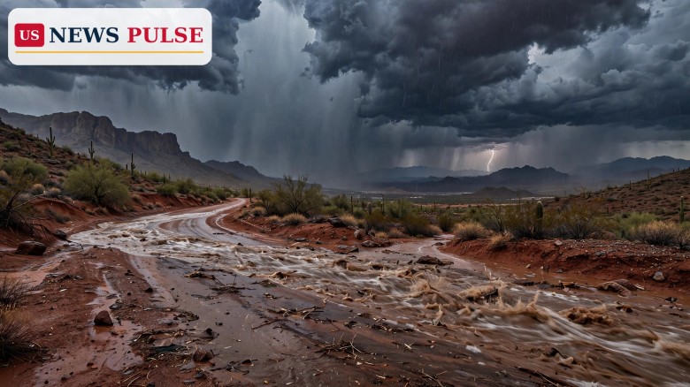
The Southwest is especially vulnerable to this kind of event, and not only because of how much rain falls. Much of the region's ground is desert soil, rock and hard-packed earth that absorbs water poorly. When heavy rain falls quickly, it runs off the surface, gathers in canyons and washes, and can rise with frightening speed. A road that looks dry in the morning can be under fast-moving water by the afternoon, and a normally quiet creek can become a torrent.
That is why scientists are stressing the combination of factors rather than any single storm. The El Niño is supplying unusual moisture. The jet stream and passing weather systems are steering storms across the region again and again. And the landscape itself converts that rain into flood risk efficiently. The result has already been seen in surging rivers, including the Salt River surge through Phoenix as Arizona released record water from Verde dams, and in evacuations and road closures across the region.
Reactions and Expert Warnings
Jeff Masters, a meteorologist with Yale Climate Connections, put the event in historical context with a phrase that has since travelled widely. “We've had super El Niños in the past, but this is a super duper El Niño,” he said. It was a warning that this event sits beyond even the strong El Niños forecasters use as benchmarks.
Other researchers echoed the concern about what comes next. Park Williams of the University of California, San Diego, said: “The dice are certainly loaded for more heavy storms this winter and spring.” Daniel Swain, also of the University of California, said precipitation is occurring “to a degree we actually haven't seen before.” Taken together, the message is consistent: the rain so far is not an isolated spike, but part of a pattern that remains loaded in favour of further heavy storms.
Why It Matters
The stakes go beyond impressive rainfall totals. Flooding in the Southwest threatens homes near washes and rivers, washes out roads, disrupts travel and power, and puts lives at risk when drivers or walkers misjudge fast water. The recent flooding has already forced evacuations, closed highways and strained emergency services, and the broader storm system has since pushed severe weather further east, as covered in the cross-country storm threatening the Southeast and East Coast.
What Happens Next
Forecasters expect the event to peak in December, when it can more strongly harness jet streams to produce more extreme storms across the western United States. That timing matters: December is when winter storm tracks typically strengthen, and a peak then could mean the most powerful phase of this El Niño coincides with the season's most active weather.
Residents across the Southwest should watch official forecasts and flood warnings closely, avoid driving through flooded roads, and remember that water depth and speed are difficult to judge from a vehicle. The next formal check on the event's strength comes with NOAA's November 12 update, but the practical warning is already clear: this El Niño has not finished, and the winter ahead could bring more of the same, only stronger.
Frequently Asked Questions
What is a “super duper” El Niño?
It is Jeff Masters' description of the current El Niño, beyond past super El Niños, with Pacific warming fuelling unusually heavy rain.
Why does El Niño cause flooding in the Southwest?
El Niño warms Pacific waters and adds moisture to the air; storms drop heavier rain, and dry desert ground absorbs water poorly, so flash flooding follows.
How much rain has fallen so far?
More than 20 trillion gallons fell on the Four Corners states and Nevada in two weeks, per Ryan Maue, with 15 gauges at all-time record crests on November 1.
When will this El Niño peak?
It is expected to peak in December, strong-to-very-strong through January to March 2027, per NOAA's Climate Prediction Center.
Is more heavy rain expected this winter?
Yes. Park Williams says the odds are loaded for more heavy storms this winter and spring, though each storm depends on shorter-term forecasts.
US News Pulse will follow forecasts, river levels and flood warnings across the Southwest as this El Niño develops.
Leave a Comment