


 | Today's Date:




Southwest Record Flooding: Rivers Hit Record Crests as Storm Heads to Election Day
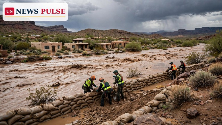
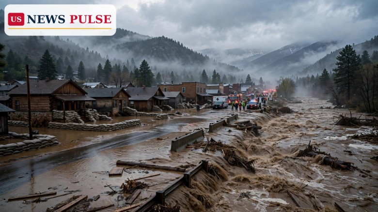
Southwest record flooding has pushed more than 10 rivers, creeks and washes in Arizona and southwest Colorado past major flood stage — the highest level — and a few have set new record crests, as a storm that dropped multiple months' worth of rain finally begins to ease in the Southwest and push east towards Election Day. The storm forced evacuations and rescues in at least a dozen counties across Arizona, Colorado and New Mexico, left crews searching for a missing man in Flagstaff, and prompted rooftop rescues around Sedona, even as forecasters warned that flooding on some swollen waterways could last through at least Tuesday.
Record flooding was unfolding on Monday along the Little Colorado River near Winslow, Arizona, and the Gila River near Solomon, Arizona, according to the National Weather Service. The Gila River was more than 2 feet higher than the level capable of flooding several homes and businesses on the north sides of Solomon, Safford and Thatcher, Arizona. In Colorado, evacuations had been ordered along the San Juan River in Pagosa Springs, which surged past major flood stage for the second time in about 10 days, with Sunday evening's crest nearly 2 feet higher than the destructive flooding on October 23.
Key Points
- More than 10 rivers, creeks and washes in Arizona and southwest Colorado surged past major flood stage, with a few setting new record crests.
- Record flooding was unfolding on the Little Colorado River near Winslow and the Gila River near Solomon, where the river was over 2 feet above the level that floods homes and businesses.
- The storm forced evacuations and rescues in at least a dozen counties across Arizona, Colorado and New Mexico, with a missing man still being sought in Flagstaff.
- In Pagosa Springs, Colorado, the San Juan River passed major flood stage for the second time in about 10 days, cresting nearly 2 feet higher than on October 23.
- The storm is now pushing into the Plains and Midwest, with severe thunderstorms possible on Monday afternoon and soggy weather forecast for Election Day on Tuesday, November 3.
What Happened
The storm that hit the Southwest was fed by tropical moisture from the Pacific, an atmospheric river that AccuWeather had warned could leave 1 to 4 inches across large parts of the region, 4 to 8 inches in some areas of central Arizona and localised totals of up to 11 inches by the end of the event. That forecast proved grimly accurate. Rain fell for days over saturated ground, waterways burst their banks, and communities that had already been warned of flash flooding found themselves cut off, evacuated or rescued from rooftops.
In Arizona, crews were still searching on Monday for a missing man who fell into fast-moving floodwater in Flagstaff, and rooftop rescues had been conducted around Sedona. Sedona had already placed zones on its eastern side, along State Route 179 and Oak Creek, in "GO" evacuation status on Sunday morning, with evacuees directed to Sedona Red Rock High School. In Pagosa Springs, Archuleta County officials had issued an urgent Sunday morning warning to residents in low-lying areas along the San Juan, Rio Blanco, Navajo and Piedra rivers: leave now, do not wait for the water to rise, do not wait for another warning.
The scale of the river flooding was what set this event apart from an ordinary autumn storm. Major flood stage is the highest category used by the National Weather Service, and more than 10 waterways reached it. A few set new record crests, meaning the water rose higher than at any previously recorded flood on those gauges. Flooding on some of those swollen waterways, CNN reported on Monday, could last through at least Tuesday, even as the rain itself eased — because rivers take time to drain, and because water moving downstream can keep levels high long after the rain stops.
Background and Context
The Southwest had been warned for days. A high-impact heavy rainfall event had been forecast for the Four Corners region for Sunday, November 1, with moisture 4 to 5 standard deviations above normal, steady heavy precipitation into the San Juan Mountains and flood watches across Arizona, New Mexico, Utah and Colorado through early November 2. That warning, and the evacuations that followed in Pagosa Springs and Sedona on Sunday, were part of the same storm now reaching its record-crest phase on Monday.
The region's geography helps explain why the flooding was so severe. Desert soils, baked hard by months of dry weather, absorb water slowly at first, so intense rain runs off quickly into washes and creeks. Narrow canyons can turn that runoff into a wall of water in minutes, which is why flash flood warnings in the Southwest so often carry the warning that floodwater can arrive with little notice. At the same time, mountain snow at higher elevations — AccuWeather estimated 15 to 30 centimetres in the higher Wasatch and Rocky Mountains on Sunday and Monday — added another layer of complexity to a storm that was already bringing rain, wind and flooding across a huge area.
Pagosa Springs illustrates the compounding effect. The San Juan River there had already flooded destructively on October 23, and Sunday evening's crest was nearly 2 feet higher than that event, the second time in about 10 days the river passed major flood stage. For residents who had only just begun cleaning up from the first flood, the second crest was not a new warning but a new disaster on top of an unfinished recovery.
Southwest Record Flooding: The Storm Pushes East
As the Southwest rain eases, the storm is pushing into the central United States with gusty winds and soaking rain. Severe thunderstorms are possible on Monday afternoon into the night across the central and southern Plains, including Dallas-Fort Worth, Oklahoma City and Wichita, Kansas. Damaging winds are the primary threat, but a few tornadoes are also possible, and the Storm Prediction Center has issued a Level 2 out of 5 severe-storm risk across parts of south-central and eastern Kansas, western and central Oklahoma and north Texas.
By Election Day on Tuesday, November 3, the storm will have lost some of its strength, but rain will still affect voters from the Great Plains and Upper Midwest south through the Mississippi Valley to the western Gulf Coast. Key races in Iowa, Kansas, eastern Texas and northern Michigan will deal with wet conditions. Isolated severe storms are possible from eastern Texas to the lower and middle Mississippi Valley. The threat of flooding rain on Election Day itself is low, CNN reported, but voters travelling to the polls could encounter ponding on roads. Dry weather will sandwich the storm along much of the East Coast and in the West, with showers in Florida, northern New England and northern California the only exceptions.
Temperatures, at least, will not add to voters' discomfort in most of the east. Highs in most of the nation's eastern half are forecast to be 5 to 20 degrees Fahrenheit above average on Election Day, while some parts of the Southwest and Plains will lean a bit cooler than average. That warmth may help turnout in the east, even where rain falls — although CNN noted that active weather tends to suppress voter turnout while sunshine has the opposite effect, according to multiple studies.
Reactions and Quotes
No single official quote captures a storm of this size, but the warnings issued by local authorities speak for themselves. Archuleta County's Sunday morning message to Pagosa Springs residents — leave now, do not wait for the water to rise, do not wait for another warning — was unusually blunt, and it reflected the speed with which the San Juan River was rising. Sedona's decision to place eastern zones in "GO" status on Sunday morning, directing evacuees to a high school shelter, was a similarly direct response to a flash flood warning that described life-threatening conditions.
Forecasters have also been clear about what comes next, and what does not. The rain easing in the Southwest does not mean the flooding is over, because river levels can remain above major flood stage for days. The severe-weather risk in the Plains on Monday is real but localised — damaging winds are the main threat, with only a few tornadoes possible — and the Election Day rain in the Midwest and South is expected to be soggy rather than dangerous, with ponding on roads the main hazard for voters. Those distinctions matter: they separate a record flood in Arizona from a wet drive to the polls in Iowa, even though both are part of the same cross-country storm.
Why It Matters
This storm matters for two reasons that go beyond the weather itself. First, it is a reminder that the most dangerous flooding in the United States is not always tied to a hurricane. A slow-moving atmospheric river over saturated desert ground can produce record river crests, evacuations and rescues across three states without a tropical name, and it can do so twice in 10 days in the same town, as Pagosa Springs has now experienced.
Second, the timing matters. The storm reaches the Plains and Midwest on the eve of the midterm elections, and its soggy tail will still be over key battleground states on Election Day. Research cited by CNN suggests that active weather tends to suppress turnout, while sunshine boosts it. In races decided by narrow margins — and several Senate and House races on Tuesday are expected to be close — even a small weather effect on turnout could matter, particularly in Iowa, Kansas, eastern Texas and northern Michigan, where rain is forecast on Tuesday.
What Happens Next
In the Southwest, the immediate task is search, rescue and recovery: finding the missing man in Flagstaff, checking homes and businesses along the Little Colorado and Gila rivers, and assessing damage in Pagosa Springs, Sedona and the other evacuated communities. River levels should be monitored through at least Tuesday, and residents near swollen waterways should not assume that a break in the rain means the danger has passed.
In the Plains, Monday afternoon and evening are the period of greatest severe-weather risk, with damaging winds and a few tornadoes possible from Kansas and Oklahoma into north Texas. On Tuesday, voters from the Great Plains and Upper Midwest through the Mississippi Valley to the western Gulf Coast should expect rain, allow extra time to reach polling places, and watch for ponding on roads. The storm is then expected to move into the Great Lakes and Mid-Atlantic by midweek, before tracking towards the Northeast, where heavy rain is also expected.
Frequently Asked Questions
Which rivers set record flood crests in the Southwest?
Record flooding was unfolding on the Little Colorado River near Winslow, Arizona, and the Gila River near Solomon, Arizona, with more than 10 rivers, creeks and washes in Arizona and southwest Colorado past major flood stage.
How high was the Gila River near Solomon?
It was more than 2 feet higher than the level capable of flooding several homes and businesses on the north sides of Solomon, Safford and Thatcher, Arizona, according to the National Weather Service.
What happened in Pagosa Springs, Colorado?
The San Juan River surged past major flood stage for the second time in about 10 days, with Sunday evening's crest nearly 2 feet higher than the destructive flooding on October 23, and evacuations were ordered along the river.
Will the storm affect Election Day weather?
Yes, in parts of the country. Rain is forecast on Tuesday, November 3, from the Great Plains and Upper Midwest through the Mississippi Valley to the western Gulf Coast, with wet conditions in Iowa, Kansas, eastern Texas and northern Michigan.
Is severe weather expected on Monday in the Plains?
Severe thunderstorms are possible on Monday afternoon and evening across the central and southern Plains, including Dallas-Fort Worth, Oklahoma City and Wichita, with damaging winds the main threat and a few tornadoes possible.
Related coverage on US News Pulse:
- Pagosa Springs Flood Evacuations as San Juan River Nears Record 20 Feet
- Sedona Flood Evacuations as Oak Creek Surges Past Flood Stage in Arizona
- Arizona Flash Floods: Rescues and One Death as Southwest Braces for More Rain
- Brevard Flooding: Florida Schools Close as 11.9 Inches of Rain Swamp East Coast
Leave a Comment