


 | Today's Date:



Florida Flooding: Okeechobee Schools Close as 5-7 Inches of Rain Swamp Lake Area
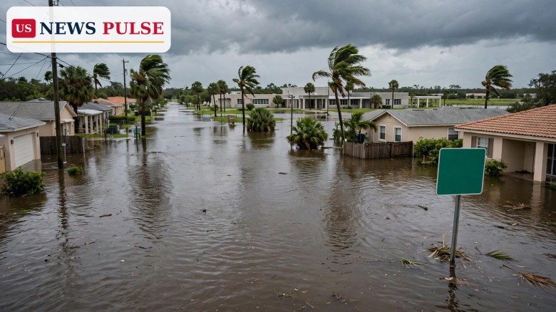
Florida flooding forced Okeechobee County to close its schools and county offices on Monday, November 2, 2026, after a developing storm system dumped 5 to 7 inches of rain around Lake Okeechobee on Sunday. With lakes and drainage systems already struggling to keep up, officials opened a shelter at Seminole Elementary School and warned that any further rain could create significant problems for communities across the Florida peninsula.
The Monday closures are the sharpest local impact so far from a slow-moving system that has spent days producing rounds of heavy rainfall across Florida. Much of the southern half of the state is under a Flood Watch as abundant moisture is expected to remain in place through at least early Tuesday, and forecasters say another 1 to 3 inches could fall south of the Interstate 4 corridor, with isolated totals of 3 to 5 inches where thunderstorms train over the same places again and again.
Key Points
- Okeechobee County closed its schools and county offices on Monday, November 2, 2026, because of flooding.
- A shelter was opened for residents at Seminole Elementary School in Okeechobee County.
- Communities around Lake Okeechobee received 5 to 7 inches of rainfall on Sunday alone.
- Much of the southern half of Florida is under a Flood Watch through at least early Tuesday.
- Another 1 to 3 inches is possible south of Interstate 4, with isolated 3 to 5 inches where storms train over the same areas.
- Along the Atlantic coast, wind gusts could top 40 mph and seas could reach 10 feet in the first half of the week.
What Happened
The Florida Public Radio Emergency Network reported on Monday morning, November 2, that the developing storm system continued to produce rounds of heavy rainfall across the Florida peninsula, leaving some communities vulnerable to flooding. The heaviest Sunday totals were concentrated around Lake Okeechobee, where some communities were inundated with 5 to 7 inches of rain in a single day.
That volume of water matters because it did not fall on dry ground. The network reported that lakes and drainage systems in the affected areas were already struggling to keep up, which means even a smaller additional downpour can push water over roads, into yards and toward buildings that stayed dry through the first rounds of rain. It is that second-round risk — water with nowhere left to go — that drove the decision to shut schools and offices for the day rather than wait for conditions to worsen.
Officials in Okeechobee County made the decision to close schools and county offices on Monday, and a shelter was opened for residents at Seminole Elementary School. The Okeechobee School District said in a statement: "The safety of our students and staff remains our highest priority. Our teams will continue monitoring school facilities and local roadways, and we will keep families informed of further updates. Any need for a makeup day will be addressed in the days ahead."
The statement is a reminder of how local these flooding decisions are. A county-wide closure does not mean every street is underwater; it means enough roads, school facilities and drainage routes are at risk that running a normal school day — with buses on flooded roads and children travelling through standing water — is not a risk officials are willing to take. The shelter opening, likewise, is a precaution for residents whose homes or routes out may become cut off if water keeps rising.
Background and Context
This is not the first Florida flooding episode of this storm. On Sunday, November 1, a Flood Watch covered Palm Beach, Broward and Miami-Dade counties, with scattered totals of 3 to 5 inches expected through Monday and isolated totals of 5 to 7 inches possible in a few hours. That watch, covered in our earlier report, warned mainly of flooded streets and road closures, with limited building impacts, and of worse conditions near the coast at high tide.
Monday's Okeechobee development extends the picture inland and northward. Lake Okeechobee sits at the centre of Florida's drainage system, and communities around the lake are especially sensitive to repeated heavy rain: water arriving from the surrounding landscape has to drain through canals and waterways that can only move so much at a time. When 5 to 7 inches falls in a day and more rain follows, the system backs up, and low-lying roads and neighbourhoods feel it first.
The wider pattern is a familiar Florida hazard. The state is flat, much of it sits barely above sea level, and its drainage depends on a network of canals, lakes and retention areas. A storm does not need hurricane-force winds to cause serious disruption: slow, repeated bands of rain over the same area — what forecasters call training thunderstorms — can produce flood totals that rival a tropical system, street by street. That is exactly the pattern described in Monday's report, with additional rain expected where storms keep repeating over the same locales.
Farther east, in Palm Beach County, the same weekend weather forms part of the background to a separate tragedy already reported on this site: the Learjet crash on Sunday that killed all nine people on board. The National Transportation Safety Board and the Federal Aviation Administration are investigating that crash, and the Florida Public Radio Emergency Network reported that weather conditions are expected to be one of many factors investigators will examine during the coming months. No conclusion about the cause of the crash has been reported, and the flooding story and the crash investigation should not be confused: one is a weather emergency unfolding across the peninsula, the other is an aviation investigation that will take months.
Governor Ron DeSantis joined local officials to give an update on the crash and address the community, according to the network's report, which also noted that two shelters were opened for hundreds of people who had difficulty reaching their homes after the crash caused debris, damage to surrounding infrastructure, road closures and evacuations in the adjacent area.
Florida Flooding: What the Forecast Means for the Rest of the Week
The immediate question for Florida residents is how much more rain is coming, and for how long. The Monday report says abundant moisture is expected to remain in place through at least early Tuesday, with the southern half of the state under a Flood Watch. South of Interstate 4, another 1 to 3 inches is possible, with isolated 3 to 5 inches where thunderstorms train over the same places. Those are not trivial amounts on top of Sunday's 5 to 7 inches around Lake Okeechobee.
Conditions along Florida's Atlantic coastline are also expected to deteriorate as the developing storm system moves offshore. The combination of the strengthening storm and a ridge of high pressure centred over the mid-Atlantic will make beach conditions hazardous, with rip currents, coastal flooding and erosion possible. Wind gusts through the first half of the week could top 40 mph, while seas are expected to reach as high as 10 feet. Both swimmers and boaters are advised to use extreme caution through the week, as conditions will remain challenging.
There is some relief in the forecast. Models show most of the rainfall moving offshore by late Tuesday — Election Day — with the weather pattern generally becoming less active toward the latter part of the week. That timing matters for voters as well as for flood recovery: Tuesday is when Floridians go to the polls in the midterm elections, and a drier, calmer pattern would remove one obstacle from Election Day travel, even if some roads remain closed and some polling routes remain affected by standing water.
For now, the advice embedded in the official response is practical rather than dramatic: stay off flooded roads, heed local closures, and check with local officials and school districts for updates rather than assuming a normal day. Floodwater is deceptive — a road that looks passable can hide a washed-out surface, and a few inches of fast-moving water can sweep a vehicle off the road. The Okeechobee closures are, in that sense, the system working as intended: a precaution taken before the water, not after it.
Reactions and Quotes
The clearest official voice in Monday's reporting is the Okeechobee School District itself, which put student and staff safety first and promised families further updates on facilities, roadways and any makeup day. That framing — safety first, updates to follow — is typical of a county dealing with a flood that is still developing rather than one that has already peaked.
No statewide emergency declaration or new state-level order was reported in the Monday morning update, and no injuries or deaths from the flooding itself were reported in the sources reviewed for this article. That absence of casualty reports is itself significant: it suggests the closures and shelter opening came early enough to keep people out of the worst of the water, rather than as a response to rescues already under way.
The crash investigation, by contrast, has drawn the state's top attention. Governor DeSantis's appearance alongside local officials on Sunday underlines how seriously Florida is treating the Palm Beach County crash, even as the flooding emergency continues separately across the peninsula. Residents in both areas — the crash zone in Palm Beach County and the flood zone around Lake Okeechobee — are being asked to follow local official guidance and to expect road closures and disruption through at least Tuesday.
Why It Matters
Florida flooding stories are sometimes treated as routine, but the Okeechobee closures show why they deserve attention. A school closure is a measurable disruption: it affects thousands of families, it signals that local officials judge road conditions unsafe for buses, and it usually means drainage systems are at or beyond capacity. When a county closes both schools and county offices, it is effectively pausing normal civic life for a day because the water will not allow it.
The timing amplifies the impact. This flood is arriving on the eve of a midterm election, when early voting has ended in many places and voters must travel to polling places on Tuesday. If rain moves offshore by late Tuesday as forecast, the worst may pass in time — but flooded roads do not dry instantly, and local election officials may still need to adjust routes, parking and access at individual polling places. Voters in flood-affected counties should check local guidance before setting out on Tuesday.
There is also a longer lesson in the Lake Okeechobee numbers. Five to 7 inches in a day is an extreme rainfall total by any standard, and it fell from a developing storm system, not a named hurricane. Florida's flood risk is not confined to hurricane season headlines; it is a year-round function of flat terrain, saturated ground and slow-moving rain. Communities that plan for that reality — with shelters opened early, schools closed proactively and drainage monitored street by street — fare better than those that wait for the water to decide.
What Happens Next
The next 24 to 48 hours will decide how this episode ends. If the forecast holds, the Flood Watch will run through at least early Tuesday, with the heaviest additional rain south of Interstate 4, and then most rainfall will move offshore by late Tuesday. Okeechobee County officials will then assess school facilities and roadways and decide whether schools reopen on Tuesday, whether a makeup day is needed, and when the Seminole Elementary shelter can stand down.
Along the Atlantic coast, hazardous beach conditions, rip currents and coastal flooding may linger even after the rain eases, with gusty winds and 10-foot seas possible through the first half of the week. Boaters and beachgoers should not assume the danger ends when the rain stops.
For residents, the practical steps are unchanged: avoid driving through flooded roads, never walk through moving floodwater, keep phones charged for local alerts, and follow the Okeechobee School District and county channels for reopening news. For the rest of Florida, the Okeechobee closures are a warning that this storm's footprint is wider than the South Florida watch that opened the weekend — and that a few more inches, falling on ground that cannot absorb them, can close a county for a day.
Frequently Asked Questions
Why did Okeechobee County close schools on Monday?
Because of flooding after 5 to 7 inches of rain fell around Lake Okeechobee on Sunday. The county closed schools and county offices, and opened a shelter at Seminole Elementary School, as lakes and drainage systems struggled to keep up with the water.
How much more rain is expected in Florida?
Another 1 to 3 inches is possible south of Interstate 4, with isolated 3 to 5 inches where thunderstorms train over the same areas. Much of the southern half of the state is under a Flood Watch through at least early Tuesday.
Is this the same storm as the South Florida flood watch?
Yes, it is the same developing storm system. The earlier watch covered Palm Beach, Broward and Miami-Dade counties; Monday's report extends the impact to the Lake Okeechobee area, where Sunday rainfall was heaviest.
Will the rain affect Election Day on Tuesday?
Forecast models show most rainfall moving offshore by late Tuesday, with conditions becoming less active later in the week. Some flooded roads may still affect travel to polling places, so voters in affected counties should check local guidance.
Are the flooding and the Palm Beach County plane crash connected?
They happened in the same weekend weather, but they are separate events. The crash, which killed nine people, is under investigation by the NTSB and FAA, and weather is expected to be one of many factors examined over the coming months. No cause has been reported.
Related Stories
- South Florida Flood Watch: Heavy Rain Threatens Miami, Broward and Palm Beach
- Las Vegas Flash Flooding: NWS Warns of Flood Risk Across Nevada and Arizona
- Bears vs Seahawks Monday Night Football Preview: Odds, Injuries, Kickoff
Featured image: an illustrative generated image of a flooded Florida street with palm trees and homes under a storm sky, not an actual photograph of Okeechobee County.
Leave a Comment